Historical Maps
Maps provide an excellent way of exploring the changes in the landscape of a particular area. The maps depicted below chart the changes in the Bready area from the beginning of the seventeenth century to the middle of the nineteenth.
Map of Ireland, c.1600
This is a portion of a map of Ireland from c. 1600. While it is not entirely accurate, it is one of the earliest maps of the area showing the names of places. ‘The Grange’ is marked, referring almost certainly to the lands attached to the former monastery. ‘Donelonge’ is also marked.
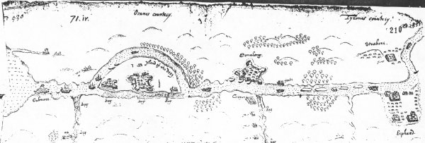
Map of Foyle Valley, c.1600
This map of c.1600 was drawn during the English campaign in north-west Ulster under the command of Sir Henry Docwra. It shows a series of English fortifications along the River Foyle including the fort at Dunnalong.
Bodley map 1609
As part of the preparations for the Plantation, Sir Josias Bodley was commissioned to prepare a series of maps of the lands that were to form part of the scheme. The image here is of an extract of the map for the Bready area. This is the earliest detailed map of the townlands in this area. While the spellings of the townlands have altered, it is still possible to recognise most of them. Note that Tullie (Tully) is incorrectly shown in County Tyrone whereas it should be in County Londonderry. Features marked on the map include the fort at Dunnalong, the monastery at Grange and a small fort along the Burndennet River.
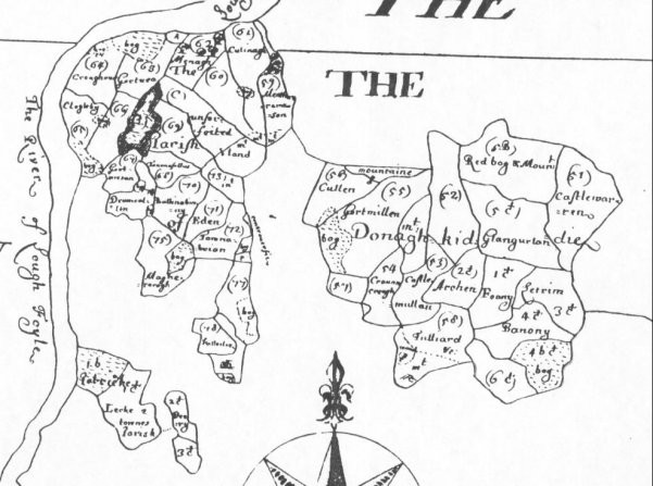
Down Survey map, c.1657
During the Cromwellian period, the government was particularly interested to find out how much land could be confiscated and granted to its supporters. Under the direction of Sir William Petty, maps were prepared showing the extent of these lands. These maps were known as the Down Survey because the information was mapped ‘down’. Because Sir George Hamilton of Dunnalong had supported the royalist cause during the wars of the 1640s, his lands were confiscated. This image is an extract from the Down Survey map showing the townlands in the manor of Dunnalong belonging to Sir George. Freeholds (lands leased to tenants in perpetuity) were not mapped.
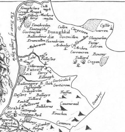
Petty map, 1685
This is a slightly later and less detailed version of the Down Survey map. It formed part of an atlas entitled Hibernia Delineato published by Sir William Petty in 1685. Townland names are given, but their boundaries are not shown.
Taylor and Skinner’s maps of the roads of Ireland, 1777
In 1777 Messrs. G. Taylor and A. Skinner published a volume showing in some detail the most important roads in Ireland as a guide to travellers. This image shows a portion of the road between Strabane and Derry along the east side of the Foyle. It marks ‘M[oun]t Hamilton´, the home of Mr Hamilton Esq., beside which the ruins of a church are marked. These ruins were those of the former monastery at Grange.
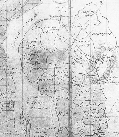
Abercorn estate map, 1804
In 1804 Henry Hood was commissioned by the 1st Marquess of Abercorn to prepare a map showing the townlands in the different manors in the Abercorn estate. This image shows the townlands in the Bready area which formed part of the manor of Dunnalong.
McCrea and Knox map, 1813
This map was prepared by two surveyors, Knox and McCrea, for the County Tyrone Grand Jury. The members of the Grand Jury were particularly interested to know the extent of the network of roads in the county at this time. This image shows the Bready area and it is interesting to note the road network at this time which differs slightly from today. ‘Sollus Bay’ is also an interesting feature that has disappeared due to land reclamation.
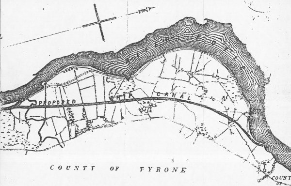
Proposed canal, 1824
Following on from the success of the Strabane canal, an ambitious scheme was devised in 1824 to construction a ship canal all the way from Derry to Lough Erne. For reasons of cost, the plan was never implemented. This is an extract from the map of the proposed route of the canal for the Bready area. It shows that there was a dense network of roads and lanes in the area at this time.
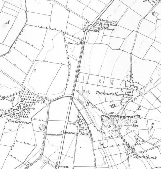
Ordnance Survey map, c.1858
In 1824 a House of Commons committee recommended that a survey of Ireland be carried out at a scale of 6 inches to the mile. The engineers of the Ordnance Survey were given the responsibility for completing this massive mapping exercise. The 1st edition of the Ordnance Survey maps was completed in the 1830s. This was followed by a revision which was completed for the Bready area in the late 1850s. The revised maps were more detailed than the originals because, among other things, they marked field boundaries. This image is an extract from the Ordnance Survey map of c. 1858 for the Bready area. It shows that the village of Bready did not exist at this time.
We hold over 30,000 records dating back to the 1600's from Bready area of north County Tyrone
Search our database records for free and discover your family history

